Usage
← The QTViewer | ● | Usage Example →
The application can be started without command line parameters:
./qtviewer

Then the application will show the entire earth on startup.
The application also accepts a list of urls as parameters. Each url needs to point to a geotiff image layer or a tileset directory.
Usage on the unix terminal:
./qtviewer { <tileset url> | <image.tif> }
Then the application will zoom into the first specified argument.
Image Layers
An image layer can contain imagery (color layer) or elevation information (dem layer).
The usual file format for color and dem layers is geotiff. See http://www.gdal.org for more information on that format and additional tools to process geotiff images.
Tileset URLs
A tileset url can point to a regular libGrid or VTBuilder (vterrain.org) tileset. The tileset directory layout of each tileset (uri or url) has to be:
| elev/ | directory of elevation tiles |
| elev.ini | ini file for elevation directory |
| imag/ | directory of imagery tiles |
| imag.ini | ini file for imagery directory |
The elev and image directories contain the tiles of the tileset stored in the proprietary libMini DB format:
- The DB format provides mip-mapped s3tc-compressed image data.
- The DB format also provides lzw-compressed floating point elevation data.
User Interface
The QTViewer user interface supports drag and drop of geo-referenced images and tileset urls.
The images are displayed as 3D thumbnails at the geo-referenced position, whereas the tilesets are displayed in full 3D. The images and tilesets are also displayed in a list view on the right.
Right-clicking at the list view triggers a context menu with a variety of available operations:
- A single layer can be opened.
- It is displayed as flat geo-referenced thumbnail.
- A single layer can be inspected.
- Info about its size and geo-reference is shown.
- A single dem layer can be shaded.
- A diffuse noon lighting technique is applied.
- Multiple images can be selected or unselected.
- Multiple selected images can be resampled to a produce a tileset.
- A tileset is displayed in full 3D.
- Its appearance takes both selected color and dem layers into account.
- At least a single dem layer must be selected.
- Resampling takes place in a background thread.
- Progress is shown in percent below the list view.
- Resampling is a computationally expensive operation and can take several minutes to hours.
- It produces a number of tiles that are stored in the proprietary libMini DB format.
- For more information about resampling, please see the libGrid tutorial.
- After resampling, the original flat layers are hidden and replaced by the 3D resampled tileset.
- The tiles of the tileset are paged in and out on demand.
- Therefore, a tileset is in principle not limited in size or extent.
- A single layer or multiple selected layers can be removed, finally.
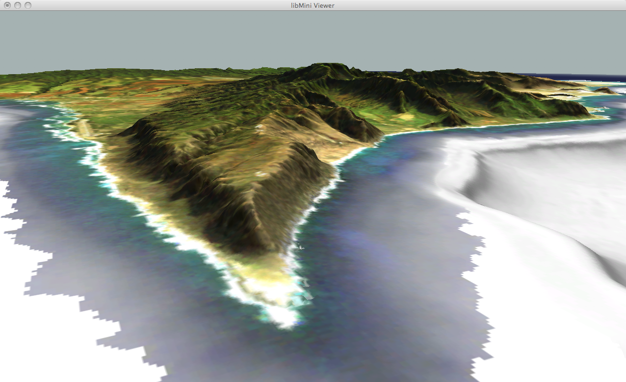
Example Data
For example, you can drag&drop a tileset data directory into the viewer window:
Download the Hawaii or Fraenkische demo data from the tileset section and drag&drop the HawaiiTileset or FrankischeTileset directory into the viewer window. Double-clicking on the layer brings the respective tileset into view.
You can also drag in layers from the libGrid data directory:
http://sourceforge.net/p/gridlib/code/HEAD/tree/libgrid/data/
The best way to get that data directory is to check it out via svn:
svn checkout http://svn.code.sf.net/p/gridlib/code/libgrid/data data
← The QTViewer | ● | Usage Example →